


Learning Map (Pilot)

The Learning Map is an activity that visualizes the stages of a learning path as interconnected points on a background image. The points represent the activities that learners must complete in order to progress step by step from the start to the end of the learning path. The points also indicate individual learning progress. The links between the stages are predetermined, but the individual learning path can be differentiated by forks.
The activity will be made available to interested teachers for testing and evaluation in the summer semester of 2026 as part of a pilot phase. If you would like to use the learning map in one or more courses, please contact RWTHmoodle Support at the IT Service Desk.
General information and notes on the pilot phase can be found in the general conditions for participation in the pilot phase (PDF).
Example
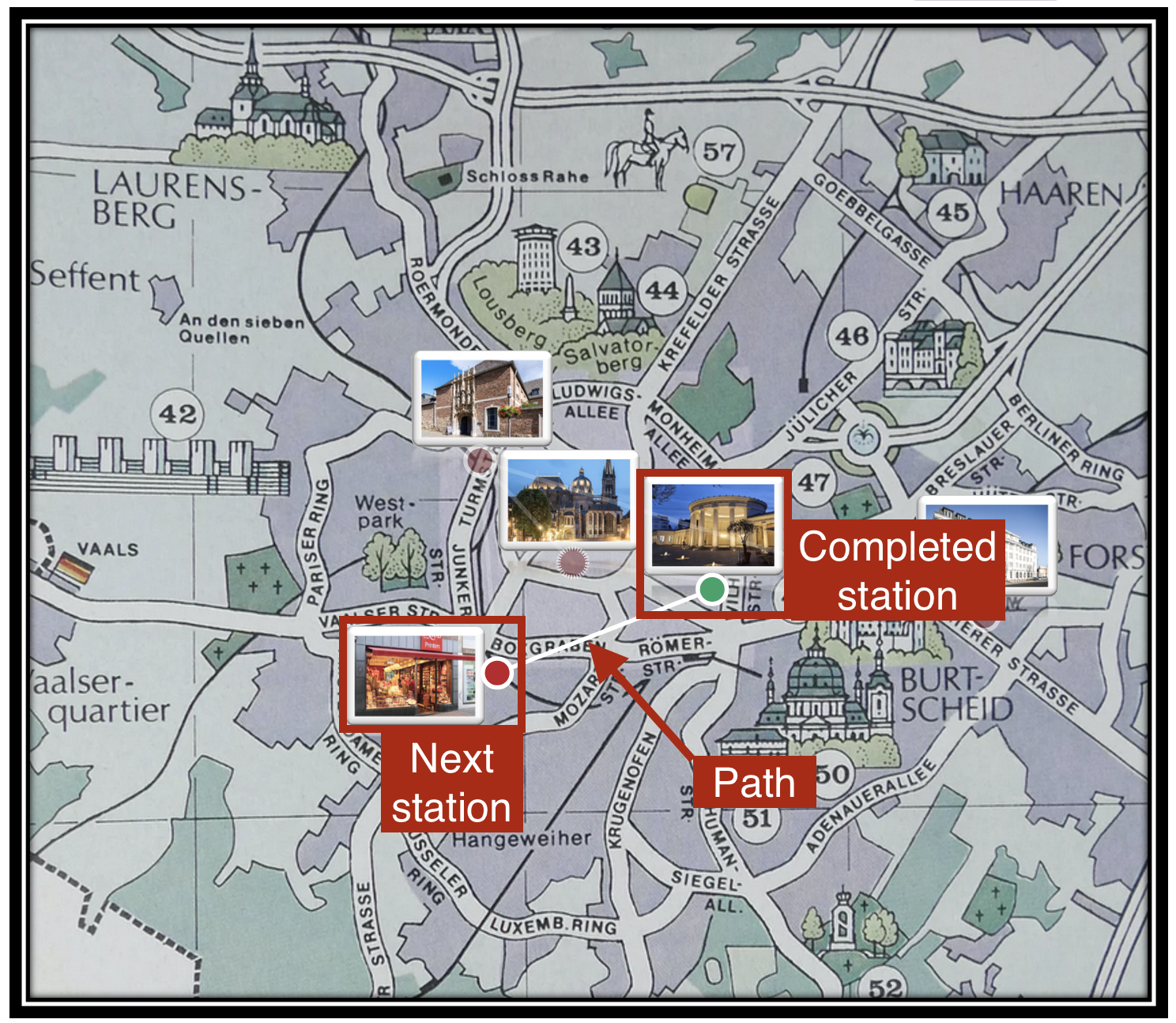
Below is an example of a learning map from the learner's perspective. Here, stations in Aachen such as the Printen bakery or the cathedral treasury are marked on a historical map, which the learners visit one after the other and solve puzzles (= quiz activities) in search of the Printen treasure. The aim is to gradually get to know the city you have just moved to in a playful way. Green dots mark completed tasks, i.e., solved puzzles. A white line extends from the green dots as a continuation of the learning path to the next stop, marked in red.
Further Information
In the editing view of the learning map, you will find integrated instructions for creating and editing a learning map. Further information on how to use the learning map and its possible applications can be found on the BayernCloud Schule (ByCS) website under the topic of learning maps (German only).
